
What to expect with the winter storm this weekend
January 21, 2026
By Mary Beth Gahan
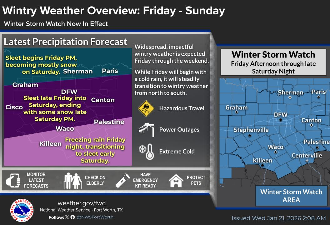
Denton County is under a winter storm watch and is expected to see moderate to heavy mixed rain, sleet and snow this weekend.
The National Weather Service forecast has rain starting early Friday as a cold front arrives in the area. The timing of the winter precipitation has moved up and may impact the afternoon and evening commute. It could arrive as soon as 2 p.m., but most likely around 6 p.m. for southern Denton County. Temperatures are expected to drop to around 34 by 5 p.m. and the precipitation will likely change to freezing rain and sleet.
On Saturday, it is forecast to be all sleet, freezing rain or snow. The moisture should move out by late Saturday or Sunday morning, according to the NWS.
“While it is still too early to put out specific amounts, moderate to heavy accumulations of snow, sleet or freezing rain are expected in addition to the very cold temperature,” the NWS wrote in a forecaster’s discussion on Tuesday.
Temperatures are expected to stay below freezing temperatures until at least Monday, with lows Saturday and Sunday night in the single digits or teens.
Town Manager James Childers said at Tuesday’s town council meeting that they are holding an emergency management meeting on Wednesday and have trucks ready to prep streets.
“We're going to do our best to have the roads drivable this weekend," Childers said.